There was one carving on the night sky map that could not be explained and did not correspond with a known star. “One interesting possibility is that there was a bright star at the location that produced the supernova or that the supernova likely failed and left behind a black hole as a remnant,” the investigators stated.
Recently, comprehensive charts of the night sky from almost 2,400 years ago were discovered by Italian researchers.
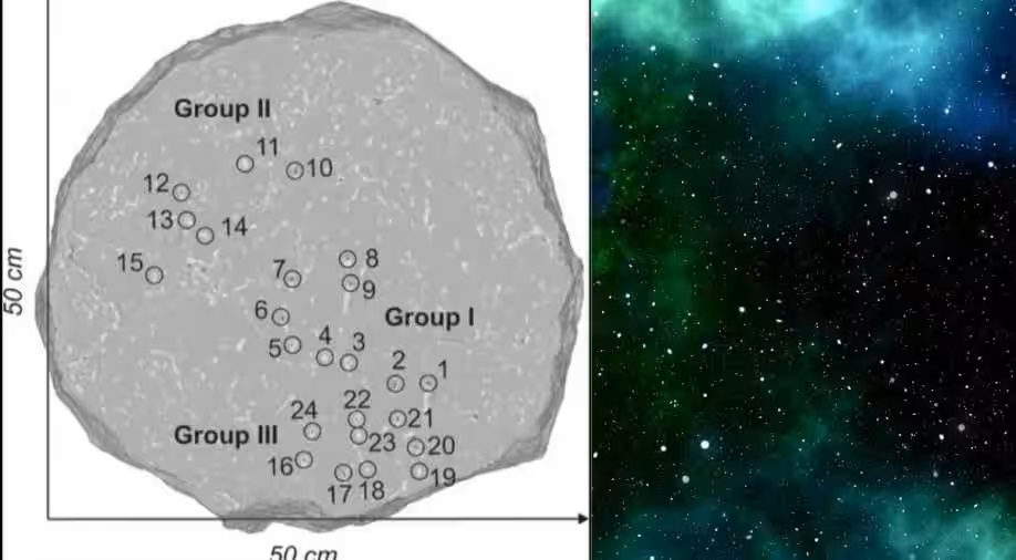
A chart engraved into a circular white stone in an old fort in northern Italy was unearthed, according to a study published in the journal Astronomical Notes on November 22.
With 29 engravings, the map is roughly the size of a car tire. A statistical analysis shows that the engravings were undoubtedly made by humans. In a press release, Italy’s National Institute of Astrophysics stated that all but one of the sculptures correspond to stars in the night sky.
According to the researchers, the map is “very complete, with all bright stars represented,” including the Pleiades, Scorpius, and Orion constellations.
One engraving, meanwhile, defied explanation and did not correspond with an existent star. “One interesting possibility is that there was a bright star at the location that produced the supernova or that the supernova likely failed and left behind a black hole as a remnant,” the investigators stated.
The map may have been used by people to monitor seasonal changes prior to starting agricultural activity. The map is considered to date between 1800 and 400 BC by the study. It is among the oldest images of the night sky that have ever been discovered.
The study did point out that making these maps does not require a high level of spatial expertise. “A measurement unit of angular distance, such as the width of a finger or a simple ruler, and basic counting skills are sufficient,” the investigators stated.
The Greek astronomer Hipparchus developed a method for comprehending star motion some 2,200 years ago. His creation of the earliest known star catalogue made him renowned. His method is still used by scientists to chart celestial objects. He utilized a coordinate system like to latitude and longitude to determine the exact location of the stars, imagining Earth to be in the center of a celestial sphere.
Historians, however, are unsure of Hipparchus’ precise method of star measurement. National Geographic speculates that he might have utilized an armillary sphere, a mechanical apparatus that rotates to show the different regions of the celestial sphere.
The first known evidence supporting Hipparchus’ star coordinates was discovered in a Latin translation of a celestial poetry from the eighth century AD. As a sort of annotation, these coordinates were incorporated into the poem.


